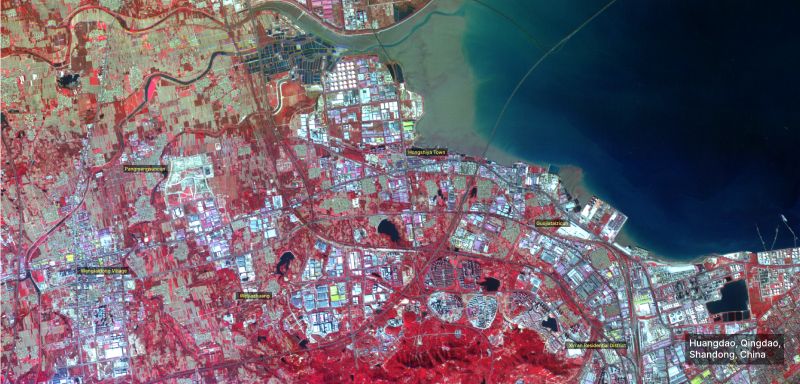
We present a vibrant view of Huangdao, Qingdao, in the Shandong province of China, captured by our AFR satellite using a Near-Infrared (NIR) false color composite.
The striking red hues highlight the lush vegetation, while the contrasting colors of urban areas and the varying shades of blue in the coastal waters add depth to this dynamic landscape.
The image features key locations, including Pangmengsuncun, Wangjiadian Village, Hongshiya Town, and the bustling Xin’an Residential District, along with industrial and coastal areas.
The diverse blues in the water bodies provide crucial insights into sediment distribution, water quality, and coastal dynamics, essential for environmental monitoring and sustainable coastal management.
Stay tuned for more spectacular views from around the globe every week!
Overview
- Service Type: Electronics & Engineering